Accommodation reservations can be made by calling 0263-95-2036.
An inn in the middle of nature, recommended as a base for hiking and mountain climbing
Business
period
April 26th to early November

ON Season Employee Recruitment

ON Season Employee Recruitment
Introducing the Kamikochi hiking area

Kappa Bridge ~ Myojin Tour Course
A 6-minute walk from Kamikochi Bus Terminal will bring you to Kappa-bashi Bridge. From Kappa-bashi Bridge, walk slowly along the left bank of Azusa River to Myojinkan. You can take a rest.

From Kappa-bashi bridge, the trail splits into left bank and right bank.
The bus stop on the left bank is a shortcut to the Yarigatake Highway and Myojin. 2.7 km of the path takes about 45 minutes to walk slowly.
If you do not have enough time, or in case of rain, please walk this way.
The Kamikochi Visitor Center is located just after the start of the walk and shows the natural splendor of Kamikochi.
Behind it, you will see a much larger view of the Hotaka mountain range than from Kappa-bashi bridge as you walk along the Azusa River at the Konashidaira campsite. From Konashidaira, you will walk along the dirt path for a while, listening to birdsong and taking in the scenery as you enjoy the forest.

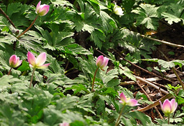
Myojin's flower garden begins about 2 km from Kappa Bridge.
Nirin grass, iwagami, rhododendron, and many other flowers (many kinds) are in bloom. When young Karamatsu trees begin to appear, the flower garden will soon be in full bloom.
On the left, you can see the southernmost peak of Mt. Behind us are Nishiho and Azusa River, and the clear stream is pleasant. From here, it is 300m to Myojin and Myojinkan.

*From Kappa-bashi Bridge to the right bank of Azusa River, walk slowly for about 5 km in the direction of Myojin. It takes about 90 minutes to walk uphill and about 70 minutes to walk downhill. The distance indicated on the sidewalk is different from the actual measurement.
Soon you will come to the Takezawa Marshland, which is thick with ferns and other plants. If you look up, you can see Mt. And there is the entrance to Takesawa, which is usually used for descending from Okuhotaka. For a while, you will climb along a long and narrow footpath and a wooden path. Eventually a marshy area will appear and you will be downstream of Myojin Pond.

Just before Myojin Bridge, a 3-minute walk to the left brings you to Hotaka Shrine and Myojin Pond.
Cross the Myojin Bridge and walk 3 minutes to Myojin and Myojinkan.

Basically, the peaks of Mt. Myojin are the object of worship for HotakaGod, so the regular route is to worship from Myojin, cross Myojin Bridge, and head to the shrine, which saves time.
You may walk 5 minutes from Myojin and visit Myojin Pond, but the best time to visit Myojin Pond is at 6:00 AM.
From Myojin, there is only one road that can be walked regularly, and from the branch at Tokumoto Pass, the road gradually becomes a mountain road. Those who wish to reach the top of the Alps or other summits should have sufficient information and equipment, and register at the Tokugo Bridge at the entrance to Tokumoto Pass, where there is a sign for the Myojin trailhead. The trip to the pass takes 2.5 to 3 hours
Taisho Pond - Kappa Bridge Course
Take the Kamikochi Line bus and get off at Taisho Pond.
From Taisho Pond, take the walking trail for about 20 minutes to the junction with Tashiro Pond,
Let's visit Tashiro Pond.
It takes about 30 minutes from the Tashiro Pond branch to the Tashiro Bridge.
From here, it takes about the same time whether you go along the right bank or the left bank of Azusa River.

The left bank and right bank of the Azusa River are the left and right as seen from upstream.. This is easy to get wrong.
From the left bank, you can see the general Hotaka mountain range. Nearby is the Imperial Hotel, and you can get a ticket for tomorrow's bus at the bus stop.You can come from the right bank while looking at the hotel area. You may also take a break at a hot spring hotel. A relief of Lord Weston, who discovered and introduced the hidden Kamikochi Basin.
If you look back, you will reach the familiar Kappa Bridge, about 20 minutes from Mt. Yakedake and Tashiro Bridge.